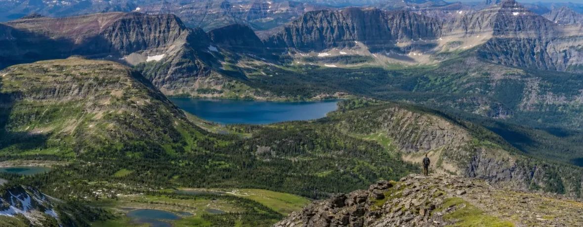
Glacier National Park is 1,012,837 acres, or 1,583 square miles [4,100 sq km], in northwest Montana. That means how big is Glacier National Park has a clean answer: large enough to hold 745.9 miles [1,200 km] of trails, 762 lakes, 563 streams, and 175 mountains.
How big is Glacier National Park?
Glacier National Park covers 1,012,837 acres [409,881 ha].
That is the figure listed by the National Park Service on its Glacier National Park Fact Sheet, along with the park’s 1,583 square miles [4,100 sq km] of total area. On a map, that block of protected land sits hard against the Canadian border in northern Montana, with Waterton Lakes National Park on the other side.
Glacier’s size is not just a bragging-rights number. It explains why the park feels so different from entrance to entrance. Lake McDonald, Many Glacier, Two Medicine, St. Mary, North Fork, and Goat Haunt are not quick little corners off one central parking lot. They are separate mountain worlds stitched together by valleys, passes, trails, and long drives.
What do Glacier National Park’s size numbers look like at a glance?
The short version: Glacier is huge, high, wet, rugged, and trail-heavy.
| Feature | Official number | What it means for you |
|---|---|---|
| Total park size | 1,012,837 acres; 1,583 square miles [4,100 sq km] | You cannot “see Glacier” in one rushed afternoon. |
| Exterior boundary | 205 miles [330 km] | The park has multiple regions, entrances, and travel patterns. |
| Trails | 745.9 miles [1,200 km] | Day hikers and backpackers both have deep options. |
| Highest mountain | Mount Cleveland, 10,448 feet [3,190 m] | Big relief, fast weather shifts, and real alpine terrain. |
The same NPS fact sheet lists 762 total lakes, 2,865 miles [4,610 km] of streams, and Logan Pass at 6,646 feet [2,025 m]. Those numbers explain the park’s look: sharp ridgelines, glacial basins, cold water, and trails that climb straight out of deep valleys.
How big is Glacier National Park compared with what you can actually hike?
You can hike 745.9 miles [1,200 km] of listed trails, but you will only sample the park on a normal trip.
The National Park Service describes Glacier as having more than 700 miles of trails on its Hiking the Trails page. That trail system ranges from short frontcountry walks to remote backpacking routes where one pass can eat most of your day.
This is where many first-time visitors misjudge the park. A five-mile [8 km] hike in Glacier can feel much larger than the number suggests. Elevation gain, snow patches, bear-aware travel, heat, wind, parking, and shuttle timing all matter. Trail miles are not treadmill miles here.
For hikers, the park’s size breaks into practical zones:
- Lake McDonald and Apgar: West-side access, big water, forested trails, visitor services.
- Logan Pass: High alpine scenery, short summer season, heavy demand.
- Many Glacier: Classic long day hikes, big wildlife country, steep-walled valleys.
- Two Medicine: Quieter feel, strong day-hike choices, east-side weather exposure.
- North Fork: Rougher access, fewer crowds, more self-reliance required.
How much of Glacier National Park feels wild?
Most of Glacier feels wild because the developed footprint is small compared with the park’s total size.
The NPS fact sheet lists 963,155 acres as de facto wilderness, or 1,489.3 square miles [3,857 sq km]. That is more than 95 percent of the park’s listed acreage. You feel that ratio fast once you leave the road corridor. The sound drops. The valleys lengthen. The map starts looking less like a tourist brochure and more like a commitment.
Glacier also has 65 backcountry campgrounds with 208 sites, according to the same NPS fact sheet. That does not mean you can wander off and sleep anywhere you like. It means the park has a managed wilderness-style system built for protection, spacing, and bear-country realities.
What does Glacier’s size mean for planning a trip?
Plan by region first, then choose hikes.
That is the move. If you pick trails scattered across the park, you can burn your best hiking hours sitting in traffic or driving around mountains. Glacier’s acreage looks clean on paper, but the terrain makes travel indirect. Valleys run long, passes close seasonally, and one full parking lot can change your day.
- Choose your base area. West Glacier works well for Lake McDonald and Apgar; St. Mary works well for the east side; Many Glacier and Two Medicine reward staying close.
- Group hikes by valley. Do not plan a Many Glacier hike and a Two Medicine hike as one casual day unless you have checked current drive times and road status.
- Start early. Glacier’s famous trailheads and parking areas can fill during peak season.
- Carry offline maps. NPS says cell phone coverage is not available outside Apgar and St. Mary on its hiking page.
- Check trail and area closures. Bear activity, snow, fire, construction, and weather can close areas fast.
What rules, fees, and permits change how you use that space?
As of November 2026, you need to check entrance fees, vehicle reservation status, and backcountry permits before you build your itinerary.
On the official Fees & Passes page, NPS lists Glacier’s standard entrance pass range as $20-$35 and says the park does not accept cash. The same page states that no vehicle reservations are required in any areas of the park in 2026. That is a current 2026 rule, not a forever promise, so check again before a future summer trip.
As of November 2026, NPS also states on its Permits & Reservations page that a wilderness use permit is required for visitors who want to camp in the backcountry. You can seek a permit online in advance or in person on a first-come, first-served basis at a backcountry ranger station, subject to availability.
Before you go, run this quick checklist:
- Entrance pass purchased or ready to buy by card.
- Current vehicle reservation rule checked for your travel year.
- Trail status checked for your exact hiking area.
- Backcountry permit secured if sleeping beyond frontcountry campgrounds.
- Offline maps saved before leaving reliable service.
- Bear-country food storage and distance practices reviewed with current NPS guidance.
Related reading
- How Big Is Yellowstone National Park?
- How Big Is Yosemite National Park?
- Logan Pass and Going-to-the-Sun Road: Opening and Access
- How Big Is Kruger National Park?
FAQ
How many acres is Glacier National Park?
Glacier National Park is 1,012,837 acres [409,881 ha]. That official NPS number equals 1,583 square miles [4,100 sq km].
How many square miles is Glacier National Park?
Glacier National Park is 1,583 square miles [4,100 sq km]. That makes it large enough that most trips focus on one or two regions, not the whole park.
How many miles of trails are in Glacier National Park?
The NPS fact sheet lists 745.9 miles [1,200 km] of trails in Glacier. The park’s hiking page describes the system as more than 700 miles of trails for day hikes and extended backpacking trips.
Is Glacier National Park all wilderness?
No, not all of it is legal designated wilderness. The NPS fact sheet lists 963,155 acres as de facto wilderness, while developed roads, campgrounds, lodges, visitor areas, and administrative sites serve visitors in specific corridors.
Can you see Glacier National Park in one day?
You can see a slice of Glacier in one day. You cannot meaningfully cover a 1,583-square-mile [4,100 sq km] mountain park with 745.9 miles [1,200 km] of trails in a single day.
Do you need a permit to hike in Glacier National Park?
You do not need a backcountry camping permit for ordinary day hiking. As of November 2026, you do need a wilderness use permit if you plan to camp in the backcountry, and you still need a valid entrance pass to enter the park.