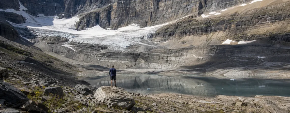
Glaciers in national parks are disappearing, and the loss is real, measurable, and already changing hikes. In Glacier National Park, 26 named glaciers still met the 25-acre [0.1 sq km] benchmark in 2015, nine fewer than in 1966; NPS warns some may now fall below that line. The right response is honest interpretation, safer trail planning, and faster climate action. Glacier National Park’s glacier overview explains the current count and definition. (home.nps.gov)
Are glaciers in national parks really disappearing?
Yes, and the trend is not subtle.
The cleanest example is Glacier National Park, where the name has become both a promise and a warning. NPS says 26 named glaciers met the 25-acre [0.1 sq km] size threshold in 2015, down from 35 in 1966. That does not mean the park is ice-free, and it does not mean every white patch on a shaded slope is a glacier. It means the moving, long-lived ice bodies that helped shape the park are shrinking below the line scientists use to track them.
Across the Pacific Northwest, the picture is just as sharp. NPS monitoring for Mount Rainier, North Cascades, and Olympic National Parks lists 516 glaciers larger than 25 acres [0.1 sq km], covering 52,140 acres [211 sq km]. The same program reports glacier area declines of 53% at North Cascades, 27% at Mount Rainier, and 52% at Olympic during the last century. NPS glacier monitoring data lays out those park-by-park losses. (nps.gov)
That should change how you read a map. A glacier name printed on paper is not a guarantee of bright blue ice waiting at the end of the trail. Sometimes it is a memory with a contour line.
Which national parks still have glaciers you can see?
You can still see glaciers in several U.S. national parks, but access ranges from roadside views to serious mountaineering terrain.
| National park | Glacier reality | Best hiker mindset |
|---|---|---|
| Glacier National Park | 26 named glaciers met the 25-acre [0.1 sq km] benchmark in 2015. | Use viewpoints and ranger updates; don’t expect every named ice feature to look massive. |
| North Cascades National Park | More than 300 glaciers and many snowfields make it the most heavily glaciated U.S. area outside Alaska. | Treat glacier country as rugged alpine terrain with fast-changing conditions. |
| Mount Rainier National Park | Mount Rainier has 28 named glaciers and glacier/perennial snow cover totaling 30 square miles [78 sq km]. | Enjoy big-ice views from trails, but leave glacier travel to trained, equipped teams. |
| Wrangell-St. Elias National Park and Preserve | The park holds the nation’s largest glacial system, with glaciers covering 35% of parklands. | Think expedition scale: distance, weather, rivers, and remoteness rule the day. |
North Cascades’ own page says the park complex has more than 300 glaciers and is the most heavily glaciated U.S. area outside Alaska. North Cascades glacier information also spells out why those glaciers matter to streams, fish, plants, and trail landscapes. (nps.gov) Mount Rainier’s NPS page lists 28 named glaciers and 30 square miles [78 sq km] of glacier and perennial snow cover. Mount Rainier glacier information is the place to start before planning a trip. (home.nps.gov)
Why should hikers care about disappearing glaciers national parks?
Because shrinking glaciers change the hike under your boots.
This is not only a postcard problem. Glaciers are frozen water storage, sediment movers, valley carvers, river feeders, and hazard makers. When they shrink, late-summer streamflow can change. Moraines loosen. Newly exposed rock sheds debris. Snow bridges weaken. Routes that felt straightforward in one decade can turn into rotten ice, unstable talus, or braided crossings in the next.
There is also a harder truth: national parks should not sell you nostalgia while the landscape is visibly changing. The honest trail sign says, “This glacier is smaller now.” The better trail sign shows you where it used to be, why it retreated, and what that means for the valley below. Hikers can handle the truth. You probably came outside to see the real thing anyway.
What changes on the trail when a glacier retreats?
Retreating glaciers make trails less predictable.
- More loose ground: Freshly uncovered slopes have not had centuries to settle, root, and stabilize.
- Different water crossings: Meltwater can split into braided channels, undercut banks, and surge after warm afternoons.
- Rockfall exposure: Ice that once glued rock together can vanish, leaving blocks ready to move.
- Harder route-finding: Old descriptions may mention snowfields, ice margins, or crossings that no longer sit in the same place.
- Hotter approaches: Less reflective snow and ice can mean more exposed rock, more sun, and less natural cooling near the route.
None of that means you should stay home. It means you should stop treating glacier hikes like museum visits. They are live landscapes. Read current park updates. Ask rangers specific questions. Bring a map that does not depend on one perfect snow bridge existing forever.
How should you plan a glacier-view hike now?
Plan for change, not for the photo you saw online.
- Start with the official park page. Check current trail, road, and hazard notices before you commit to a route.
- Choose a viewpoint before choosing a summit. Many of the best glacier views come from ridges, passes, and overlooks, not from stepping onto ice.
- Match the route to your skills. If a hike requires glacier travel, crevasse rescue knowledge, ropes, crampons, and ice axes, it is no longer a casual hike.
- Expect afternoon water to rise. Warm days can make glacial streams louder, wider, and harder to cross late in the day.
- Carry sun and cold protection. Ice country can burn your skin and chill you fast in the same hour.
- Bring binoculars or a zoom lens. You do not need to stand on a glacier to appreciate one.
- Turn around early if the terrain feels wrong. Fresh moraine, hollow snow, and moving rocks are not character tests.
Alaska raises the scale. Wrangell-St. Elias has glaciers covering 35% of parklands, and NPS describes the system there as the largest in the nation. Wrangell-St. Elias glacier information makes clear that glaciers are not side scenery in that park; they are the architecture. (nps.gov)
What should national parks do about disappearing glaciers?
They should tell the story more bluntly and make it easier for visitors to see the evidence.
The position here is simple: national parks should stop treating glacier loss as background science. Put the old ice margins on trail signs. Install repeat-photo stations at safe viewpoints. Update exhibits when glacier counts change. Train front-desk staff to explain the difference between a snowfield, a rock glacier, and a true glacier. Put hazard language where hikers actually make decisions: trailheads, shuttle stops, campgrounds, and route pages.
That is not politics on a signboard. That is reading the landscape accurately.
Parks should also build for the ground that is coming, not the ground that was there 40 years ago. Trails below retreating glaciers may need reroutes, hardened crossings, better drainage, and seasonal closures when slopes destabilize. Interpretive work and safety work belong together. A visitor who understands why the ice is shrinking is also more likely to understand why the trail moved.
Hikers have a role, too. Vote with your attention. Reward parks that explain change clearly. Share current route conditions without turning fragile places into social media trophies. Stay off closed areas. Keep your group small when terrain is delicate. And drop the fantasy that every famous view will wait unchanged for the next generation.
Related reading
- Why National Parks Matter
- Underrated National Parks Worth Your Time
- How National Parks Began
- Are National Parks Too Crowded?
FAQ
Will Glacier National Park lose all its glaciers?
Glacier National Park has already lost many glaciers by the scientific size threshold, and the remaining ones are shrinking. NPS says some of the 26 named glaciers counted in 2015 may now be smaller than the 25-acre [0.1 sq km] benchmark.
What is the difference between a glacier and a snowfield?
A glacier is ice thick and persistent enough to move under its own weight. A snowfield can last through summer, but it may not flow like a glacier or persist long enough to qualify.
Can hikers walk on glaciers in national parks?
Only trained, properly equipped parties should travel on glaciers. Crevasses, weak snow bridges, rockfall, and route changes make glacier travel a mountaineering skill, not a normal hiking add-on.
Which U.S. national park has the most glacier ice?
Wrangell-St. Elias National Park and Preserve has the nation’s largest glacial system. NPS says glaciers cover 35% of its parklands.
Are disappearing glaciers bad for rivers and wildlife?
Yes, especially where summer meltwater supports cold streams. NPS monitoring says glaciers deliver cold, sediment- and nutrient-rich water that helps buffer aquatic ecosystems during hot, dry periods.
What is the best way to see glaciers without technical gear?
Choose official overlooks, established trails, and ranger-recommended viewpoints. Bring binoculars, start early, and let distance do its job: the safest glacier view is often the one that keeps you off the ice.