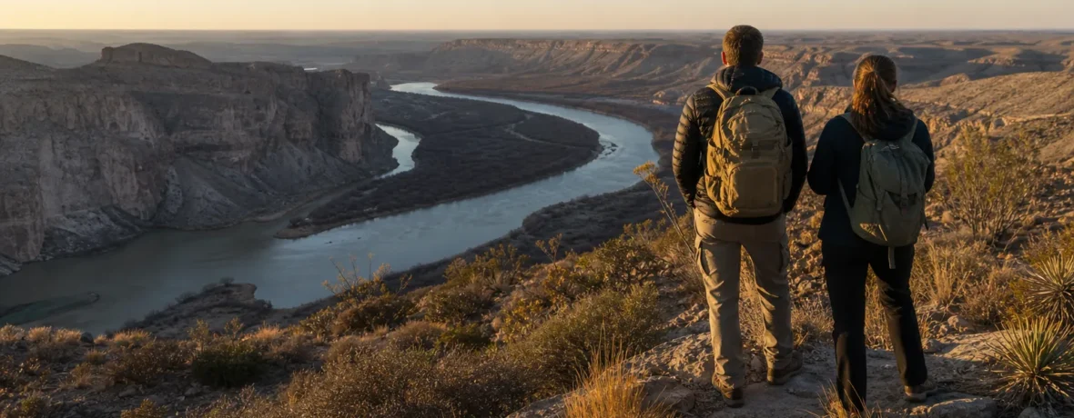
Drive. There is no public transportation to or inside the park, and the nearest major-airline airports are Midland/Odessa, 235 miles [378 km] from park headquarters, and El Paso, 330 miles [531 km]. Pick your entrance by route, fuel early, and download maps.
How do you get to Big Bend National Park by car?
You reach Big Bend by driving across far West Texas on TX 118, FM 170, US 90, or US 385.
The park sits in southwest Texas on the Mexico border, and the final approach is part of the trip. The National Park Service lists three main highway approaches: TX 118 from Alpine to Study Butte, FM 170 from Presidio to Study Butte and then 26 miles [42 km] east to park headquarters, or US 90/US 385 to Marathon and then 70 miles [113 km] south to park headquarters. Check the official NPS directions and transportation page before you leave cell service.
There are two main entrance stations for most visitors:
- Persimmon Gap Entrance on the north side, reached by US 385 from Marathon.
- Maverick Entrance on the west side, reached from Study Butte/Terlingua on TX 118.
Inside the park, Panther Junction works like the hub. From there, roads branch toward Chisos Basin, Rio Grande Village, and the Ross Maxwell Scenic Drive. Do not plan Big Bend like a compact park where you pop in, hike, and pop out. The distances are real. The desert makes them feel longer.
What is the closest airport to Big Bend National Park?
The closest major-airline airport is Midland/Odessa.
Midland International Air & Space Port is 235 miles [378 km] from Big Bend park headquarters, while El Paso International Airport is 330 miles [531 km], according to the National Park Service. Midland/Odessa usually gives you the shorter drive. El Paso can make sense if flights, rental cars, or a longer West Texas road trip line up better.
| Airport | Distance to park headquarters | Best for |
|---|---|---|
| Midland/Odessa | 235 miles [378 km] | Shortest major-airport drive |
| El Paso | 330 miles [531 km] | Marfa, Alpine, Davis Mountains, and a bigger road trip |
| San Antonio | Long Texas drive | Travelers pairing Big Bend with central Texas |
Rent your vehicle at the airport. Big Bend has no shuttle system waiting for you, no train stop at the gate, and no simple rideshare backup once you are deep in the desert.
Can you get to Big Bend National Park without a car?
No, not in any practical way for a hiking trip.
The National Park Service states that there is no public transportation to or within Big Bend National Park. That single fact shapes the whole trip. You need your own vehicle, a rental vehicle, or a fully arranged private transfer that also solves transportation once you are inside the park.
If you plan to hike, a car is more than a convenience. It is your trail connector, water cache, food locker, shade break, and exit plan. Trailheads can be widely separated. A morning hike in the Chisos Mountains and a sunset at Santa Elena Canyon are not “walk across the parking lot” neighbors.
Which entrance should you use for Big Bend National Park?
Use Persimmon Gap from Marathon and Maverick from Study Butte or Terlingua.
Pick the entrance that matches your route and first night’s lodging. Do not overthink it, but do not ignore it either. Choosing the wrong side can add a long desert drive at the end of an already long day.
- Use Persimmon Gap if you are coming through Marathon on US 385, especially from Fort Stockton, Midland/Odessa, Dallas/Fort Worth, or San Antonio via US 90.
- Use Maverick if you are coming from Alpine, Study Butte, Terlingua, Lajitas, or the west side of the park.
- Use the west-side approach if Santa Elena Canyon, the Ross Maxwell Scenic Drive, Terlingua lodging, or Big Bend Ranch State Park is your first target.
- Use the north approach if Panther Junction, Rio Grande Village, Boquillas Canyon, or a straightforward arrival from Marathon is your first target.
Park entrances are open 24 hours daily, year-round, as of November 2026. Fee stations and visitor centers may be closed after normal business hours, so read the current NPS operating hours if you are arriving late.
What is the best route to Big Bend National Park?
The best route is the one that gets you to your first base with fuel, daylight, and enough energy left to set up camp.
Here is the clean version:
- Choose your first base: Chisos Basin, Rio Grande Village, Cottonwood, Terlingua, Study Butte, Marathon, or Alpine.
- Match your gateway town to that base: Marathon for the north entrance, Study Butte/Terlingua for the west entrance.
- Fill your gas tank before the last long leg.
- Download offline maps before Alpine, Marathon, Fort Stockton, or Presidio.
- Check the official park alerts the morning you drive in.
- Arrive with water, snacks, and a headlamp, even if your plan looks simple.
From Midland/Odessa, many visitors aim for Fort Stockton, then Marathon, then Persimmon Gap. From El Paso, you can angle through Van Horn, Marfa, and Alpine, then continue toward Study Butte or Marathon depending on your lodging. From San Antonio, US 90 through Del Rio and Marathon gives you a classic long-haul West Texas approach.
FM 170 through Big Bend Ranch State Park is the scenic river road from Presidio toward Study Butte. It is beautiful, but it is not the fastest line for everyone. If you are arriving tired, hungry, or after dark, save the scenic wandering for daylight.
Do you need reservations or permits to enter Big Bend National Park?
You do not need a reservation to enter Big Bend National Park.
As of November 2026, the National Park Service says reservations are not required for park entry, but normal entrance fees are collected. Entrance fees are cashless. A private vehicle pass costs $30 and is valid for 7 days; a motorcycle pass costs $25; and an individual pass for a bicyclist or pedestrian costs $15. Check the official NPS fees and passes page before your trip because fees can change.
Camping is different. As of November 2026, NPS says all developed park campgrounds require reservations, with no first-come, first-served camping available in park campgrounds. If you plan to sleep inside the park, use the official NPS permits and reservations page and confirm your site before driving into the desert.
Backcountry use, river trips, and some group activities may need permits. Do not assume you can sort it out after a 7-hour drive and a dead phone battery.
What should you know before the final drive into Big Bend?
The final drive is remote, exposed, and short on services.
That is not meant to scare you. It is meant to keep your trip smooth. Big Bend rewards people who show up prepared and punishes people who treat it like a roadside attraction.
Pack the car before the last leg:
- Full fuel tank
- 1 gallon [3.8 L] of water per person for the driving day, plus hiking water
- Food for the arrival night and next morning
- Offline maps and a paper map
- Headlamp or flashlight
- Sun hat, sunglasses, and sunscreen
- Tire pressure checked, spare tire present, jack present
- Campground or lodging confirmation saved offline
- Credit or debit card for cashless entrance payment
As of November 2026, NPS says there are no electric vehicle charging stations in Big Bend National Park, and the closest EV charging station is 130 miles [209 km] away in Fort Stockton. Gasoline is available inside the park at Panther Junction and Rio Grande Village, with 24-hour pumps listed by the park concessioner, but you should still arrive full. Remote pumps can be down, busy, or inconvenient to your route.
Are the roads to Big Bend National Park paved?
The main roads into Big Bend are paved, but some park roads are not.
You can reach the main entrances, Panther Junction, Chisos Basin, Rio Grande Village, and many major trailheads by paved road. That makes Big Bend doable in a standard rental car if you stick to paved routes and maintained access roads.
Primitive roads are different. The park warns that travel on primitive dirt roads requires high clearance and true four-wheel drive, and that passenger cars, minivans, motorhomes, and small crossover SUVs are not suitable for those roads. As of November 2026, weather-related closures listed by NPS include the paved road between Cottonwood Campground and Santa Elena Canyon, Hot Springs Road past the overflow parking lot, River Road West to Glenn Springs Road, and Black Gap Road until further notice. Always check current Big Bend alerts and conditions before you choose a route or trailhead.
Rental car fine print matters here. Many rental agreements prohibit driving on unpaved roads. A “4×4” badge does not cancel a contract, fix a shredded tire, or make a muddy wash passable.
What is the best time to drive to Big Bend National Park?
The best arrival window is daylight, especially on your first visit.
Daylight gives you views, easier sign reading, better wildlife visibility, and a calmer first pass through the park’s long roads. Night driving in West Texas can be tiring because roads are dark, distances are large, and animals can be on or near the pavement.
Season matters too. Spring is the busiest season in the park, and summer heat can be severe in the desert. NPS notes that desert temperatures are usually well above 100°F [38°C] by late morning in the hottest months, while the Chisos Mountains can be 10-15°F [6-8°C] cooler. If your hiking plan depends on long desert trails, build your schedule around early starts and short exposure.
Where should hikers stay when visiting Big Bend?
Stay where your first hikes are, not where the map looks tidy.
Big Bend is huge in practical terms. If you want Chisos Mountains hikes, staying in or near Chisos Basin cuts down on morning driving. If you want Santa Elena Canyon, the west side near Terlingua, Study Butte, Cottonwood, or the Ross Maxwell Scenic Drive is more efficient. If you want Boquillas Canyon, Hot Springs, or the east side, look toward Rio Grande Village or the park’s east-side facilities.
Common bases include:
- Chisos Basin: best for mountain hikes and cooler high-country mornings.
- Rio Grande Village: best for the east side, river corridor, and Boquillas Canyon area.
- Cottonwood area: best for the west side when open and accessible.
- Terlingua/Study Butte: best for restaurants, lodging variety, west entrance access, and Santa Elena Canyon plans.
- Marathon: best for a quieter gateway town and the Persimmon Gap approach.
- Alpine: best for more town services, though it sits farther from the park entrances.
If you are camping, reserve first and build the driving plan second. Do not roll in expecting an empty site.
Related reading
- How to Get to Dry Tortugas National Park
- How to Get to Channel Islands National Park
- How to Get to Isle Royale National Park
- How to Get to Katmai National Park
FAQ
What city do you fly into for Big Bend National Park?
Fly into Midland/Odessa for the shortest major-airport drive. El Paso is farther from park headquarters, but it can work well if you want to visit Marfa, Alpine, or the Davis Mountains on the way.
Is there a shuttle to Big Bend National Park?
No, there is no public transportation to or within Big Bend National Park. You need a personal vehicle, rental car, or a private transportation plan that covers every trailhead and lodging transfer.
Can you drive into Big Bend National Park at night?
Yes, park entrances are open 24 hours daily, year-round, as of November 2026. Arriving in daylight is smarter for a first visit because roads are remote, services are limited, and wildlife can be difficult to see after dark.
Do you need 4WD to visit Big Bend National Park?
No, you do not need 4WD for the main paved roads and major developed areas. You do need high clearance and true 4WD for primitive dirt roads, and some roads may close after storms.
How many days do you need for Big Bend?
Plan at least 3 full days if you want to hike in the Chisos Mountains, see Santa Elena Canyon, and visit the east side of the park. With only 1 day, choose one zone and do it well instead of spending the whole day in the car.
Can you enter Big Bend without a reservation?
Yes, you can enter Big Bend National Park without an entry reservation as of November 2026. Campgrounds and lodging are separate, and park campgrounds require reservations.