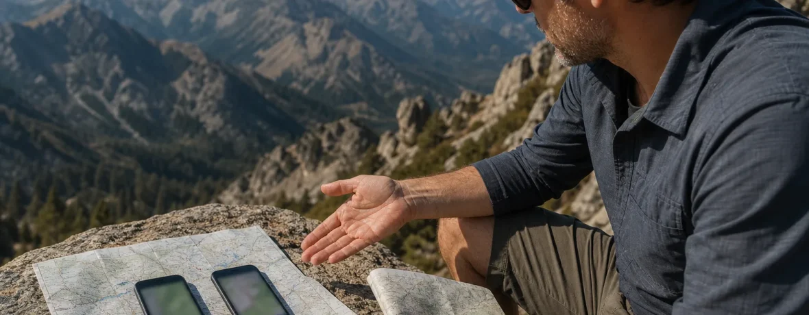
For most day hikers, the choice is simple: AllTrails for finding popular routes fast, reviews, photos, and wrong-turn alerts. Choose Gaia GPS for backcountry mapping, layered topo tools, public-land overlays, and custom routes. If you hike both local parks and remote terrain, use both.
AllTrails vs Gaia GPS: which app is better for hiking?
AllTrails is better for quick trail picking; Gaia GPS is better for map-heavy trip planning.
That is the cleanest split. AllTrails feels like a trail guide in your pocket. You search a place, filter for distance or difficulty, scan recent comments, save a route, and go. It shines when you want a known hike with a defined line: a waterfall loop, a summit trail, a city-edge greenbelt, a national park route with thousands of user photos.
Gaia GPS feels more like a digital map room. It is built for people who want to choose layers, draw their own line, compare satellite imagery with topo contours, mark bailout points, and keep moving when the trail fades. It takes longer to learn. That time pays off on backpacking trips, off-trail approaches, winter routes, hunting zones, and big public-land puzzles.
| Category | AllTrails | Gaia GPS |
|---|---|---|
| Best use | Finding established hikes fast | Planning and tracking backcountry routes |
| Learning curve | Easy | Moderate |
| Offline maps | Plus and Peak plans support phone downloads, as of November 2026 | Premium supports offline downloads and layered maps, as of November 2026 |
| Route planning | Strong for known trails; Peak adds advanced custom route tools | Strong for custom routes, waypoints, layers, and field adjustments |
| Park rules | Helpful park info, but not the legal source | Helpful land and map layers, but not the legal source |
For the cleanest answer: pick AllTrails if you mainly hike established trails under 10 miles [16 km]. Pick Gaia GPS if your trips depend on map layers, offline planning, waypoints, or land-management detail.
What are the best hiking apps for offline maps?
The best hiking apps for offline maps are the ones you download before you lose service.
That sounds obvious. It is also where many hikers get burned. Cell service drops, the map tiles never loaded, and suddenly the blue dot is floating on a blank grid. No thanks.
AllTrails says Plus and Peak members can download maps to a phone for offline use, and those downloads let you view map information and use the phone’s built-in GPS without a data signal, as of November 2026. The official AllTrails help page also says downloaded maps live under Saved > Downloads in the app. Read the current instructions on AllTrails’ offline map guide.
Gaia GPS says its free level includes waypoints, track recording, GPS use, photos, backup to gaiagps.com, sharing tracks, and printing Gaia Topo maps. Gaia GPS Premium adds the full map catalog, offline map downloads, layered map downloads, overlays such as hill-shading and slope angle, and printing all maps from gaiagps.com, as of November 2026. The details are on the official Gaia GPS membership page.
Offline map habit matters more than app loyalty. Do this before every hike where service may be weak:
- Download the route or area at home on Wi-Fi.
- Open the download in airplane mode to confirm it works.
- Save the trailhead, junctions, water sources, and bailout points as waypoints.
- Bring a power bank for long days or cold weather.
- Carry a paper map or printed backup for trips where getting lost would carry real consequences.
Is AllTrails better than Gaia GPS for finding trails?
Yes, AllTrails is usually better for finding established hiking trails quickly.
AllTrails wins the “what should we hike Saturday?” test. The app is built around discovery: search, filters, photos, route pages, saved lists, and recent trail comments. You can compare a 3-mile [4.8 km] family loop with a 9-mile [14.5 km] ridge walk without opening a full mapping workspace.
That makes it useful for local parks, road trips, national park day hikes, and new-to-you trail systems. If you want a hike with a clear start, finish, distance, elevation profile, and crowd-sourced comments, AllTrails is the friendlier tool.
There is a catch. A popular route page does not replace your judgment. User comments can lag behind storms, fires, road closures, washed-out bridges, downed trees, seasonal gates, and permit changes. Treat the app like a lead, not a final answer.
Is Gaia GPS better than AllTrails for backpacking?
Yes, Gaia GPS is usually better for backpacking and remote route planning.
Backpacking asks more from a map. You care where the ridge steepens, where the creek crosses the trail, which side of the drainage holds snow longer, and how far the next flat campsite might be. Gaia GPS is stronger here because it puts maps and layers first.
Gaia GPS says Premium unlocks more than 250 map sources, including weather and land-ownership overlays, plus specialized data for hunting, skiing, off-roading, overlanding, and professional use, as of November 2026. That current map-source information appears on the official Gaia GPS maps page.
For backpacking, Gaia’s best strengths are:
- Layer stacking: Combine topo, satellite, slope, public land, weather, and other overlays.
- Waypoints: Mark camp options, water, passes, junctions, hazards, and pickup points.
- Custom routes: Build a trip around terrain rather than a single popular trail page.
- Offline areas: Save broad map coverage for the whole zone, not only one trail line.
- Track recording: Keep a breadcrumb line of where you actually walked.
AllTrails still has a place on backpacking trips. It can help you scout trailhead access, read recent comments, and find known trail segments. But if the trip stretches across multiple drainages, unsigned junctions, wilderness zones, or snow-covered terrain, Gaia GPS gives you more control.
Which hiking app is easier to use?
AllTrails is easier for most hikers on day one.
The layout is familiar: search bar, trail cards, star ratings, photos, map, save button. You can hand it to a newer hiker and they will understand the basic flow in minutes. That matters. The app you understand is the app you will actually check before the turnoff.
Gaia GPS takes more setup. You need to understand map sources, overlays, opacity, downloaded areas, routes, tracks, and waypoints. None of that is bad. It is just more map work. If you like maps, Gaia feels powerful. If you want a quick trail pick before coffee gets cold, it can feel like too much.
Here is the blunt version:
- Use AllTrails when the question is, “Which trail should we hike?”
- Use Gaia GPS when the question is, “How exactly do we move through this terrain?”
How much do AllTrails and Gaia GPS cost?
AllTrails publishes Plus and Peak tiers; Gaia GPS publishes Free, Premium, and Premium with Outside+ tiers.
AllTrails says it offers two premium membership levels, Plus and Peak, as of November 2026. Plus includes offline trails, offline parks, offline custom areas, 3D maps, printed maps, trail conditions, wrong-turn alerts, Live Share, elevation mode, and other tools. Peak includes the Plus benefits and adds advanced map layers, advanced custom route tools, multi-day trip planning, and Outdoor Lens. Those current feature claims are on the official AllTrails premium membership page.
AllTrails’ official REI partnership terms list U.S. REI member pricing at $24.99/year for Plus and $49.99/year for Peak, with renewal at $35.99/year for Plus and $79.99/year for Peak if the member benefit is not reclaimed before renewal, as of November 2026. Prices can change, and app-store checkout can differ by platform, so confirm inside the checkout screen before paying.
Gaia GPS says its free tier supports waypoints, track recording, GPS use, photos, cloud backup, sharing tracks, and printing Gaia Topo maps. Premium adds the full map catalog, offline downloads, layered offline maps, overlays, and printing all maps. Gaia’s renewal cost should be checked in the subscription area or checkout for your account and platform, as of November 2026.
If money is tight, start free. Take short local hikes, test the interface, and see which app matches your brain. Pay only when you know you need offline maps, deeper planning, or advanced route tools.
Can you trust AllTrails or Gaia GPS for park rules, permits, and closures?
No app should be your final source for rules, permits, fees, or closures.
This is the part that can save you a ticket, a ruined trip, or a long drive to a locked gate. AllTrails and Gaia GPS can show useful park and land information, but official rules live with the agency that manages the land.
For national parks, check the specific park’s National Park Service page before you go. For reservations, timed entry, permits, cabins, campsites, and some wilderness permits, Recreation.gov says fees and reservation rules vary by location and activity, as of November 2026. Check the current policy and the specific facility page on Recreation.gov reservation policies.
For national forests, the Forest Service says motor vehicle use maps show designated roads, trails, and areas for motor vehicle use; routes not shown on motor vehicle maps are not open to public motor vehicle travel, as of November 2026. The agency also says some routes may be open only during certain times of year and for certain vehicle types. Check the official U.S. Forest Service maps page before driving forest roads to a trailhead.
For drones in national parks, the National Park Service says launching, landing, or operating uncrewed aircraft from or on lands and waters administered by the NPS is prohibited unless approved under the listed conditions and exceptions, as of November 2026. Check the official NPS uncrewed aircraft guidance before packing a drone.
Use this pre-trip rules checklist:
- Check the official park, forest, BLM, state park, or local agency page.
- Confirm entrance fees, permits, timed entry, and parking rules.
- Look for current alerts: fire closures, storm damage, road work, seasonal gates, wildlife closures, and bridge outages.
- Download the official map or PDF if one exists.
- Screenshot permit confirmations and rules pages in case you lose service.
- Recheck the morning you leave if weather, fire, snow, or flooding could change access.
Which app is better for safety?
Neither app makes you safe by itself.
A hiking app is a tool. A good one can show your location, help you stay on route, record a track, and store offline maps. It cannot make your phone battery last forever, fix a wrong permit, predict every hazard, or call for help where there is no service.
AllTrails has a strong safety angle for established routes. Wrong-turn alerts can help if you drift off a saved trail. Live Share can help someone follow your progress when service allows. Recent comments can warn you that a trail is muddy, icy, smoky, or blocked.
Gaia GPS has a strong safety angle for bigger terrain. Downloaded map areas, waypoints, and track recording help you keep context if you leave a main trail or need to backtrack. Layered maps can also help you avoid steep slopes, private land, or confusing road networks.
Pack the human safety system too:
- Tell someone where you are going and when you expect to return.
- Bring enough water for the heat, elevation, and distance.
- Carry insulation, rain protection, a headlamp, first-aid supplies, and fire-starting gear.
- Bring a paper map and compass for remote routes.
- Use a satellite messenger or personal locator beacon when a delayed rescue would be serious.
What should you choose for day hikes, backpacking, and road trips?
Choose the app that matches the trip, not the app with the loudest fan club.
For a local day hike, AllTrails is usually the pick. You can find a loop, check recent comments, save the route, and head out. For a national park day hike, AllTrails is still handy, but pair it with the park’s official page for permits, shuttles, road closures, and seasonal rules.
For backpacking, Gaia GPS usually gets the nod. Build the route, download the whole area, mark water and camp options, and keep the map layers simple enough to read under stress. Too many layers can turn the screen into soup.
For road trips through mixed public lands, use both. AllTrails helps you find the memorable short hikes. Gaia GPS helps you understand land ownership, roads, and the bigger map. That combo is especially useful in the West, where a trailhead can sit at the end of a long dirt road crossing different agencies and seasonal closures.
How do you set up either app before a hike?
Set up the app at home, not at the trailhead.
Trailhead fiddling is how people forget downloads, miss permit rules, or start late. Do the boring prep while your phone is charged and Wi-Fi is strong.
- Pick the route. Choose the trail or draw the route you plan to walk.
- Check the official land manager. Confirm rules, permits, access, and closures from the agency page.
- Download offline maps. Save the route plus enough surrounding area to reroute if needed.
- Mark key points. Add the trailhead, major junctions, water, camp, viewpoints, bailout options, and hazards.
- Test offline mode. Turn on airplane mode and open the map.
- Charge everything. Phone, watch, headlamp, power bank, satellite messenger.
- Share the plan. Send your route, vehicle location, and return time to someone reliable.
So, which hiking app should you download first?
Download AllTrails first if you want fast trail discovery; download Gaia GPS first if you want serious maps.
If you are new to hiking apps, start with AllTrails. It gives quick wins. You will find nearby hikes, understand distance and elevation, and get a feel for saving routes. Add the paid tier only when offline maps and wrong-turn alerts matter for your hikes.
If you already read topo maps, plan backpacking routes, hike away from obvious trails, or need public-land detail, start with Gaia GPS. Give yourself time to learn it before the trip. Gaia rewards practice.
The smartest answer for frequent hikers is not either-or. Use AllTrails to discover and vet popular trails. Use Gaia GPS to plan and track complex terrain. Then check the official park or agency page before you commit.
Related reading
- National Park vs National Forest vs BLM Land
- National Monument vs National Park
- Hiking Shoes vs Hiking Boots: Which Should You Buy?
- Softshell vs Hardshell Jackets for Hiking
FAQ
Is AllTrails more accurate than Gaia GPS?
No, not across the board. AllTrails can be very useful for established trail routes, while Gaia GPS can be stronger for map layers, custom routes, and backcountry context.
Does Gaia GPS work without cell service?
Yes, with the right setup. Gaia GPS Premium supports offline map downloads, including layered maps, but you need to download the maps before you lose service.
Does AllTrails work without cell service?
Yes, on Plus and Peak plans. AllTrails says those memberships allow offline phone downloads, so test the saved map in airplane mode before leaving home.
Which app is better for national parks?
AllTrails is usually better for finding popular national park hikes. Gaia GPS is better for wider map planning, but neither replaces the official NPS page for permits, closures, entrance rules, shuttles, or drone restrictions.
Should I pay for AllTrails or Gaia GPS?
Pay when offline maps or advanced planning features solve a real problem for your trips. If you only hike short local trails with reliable service, the free version may be enough.
Can I use both AllTrails and Gaia GPS?
Yes, and many serious hikers should. Use AllTrails for trail discovery and recent route comments, then use Gaia GPS for layered mapping, waypoints, and backcountry planning.