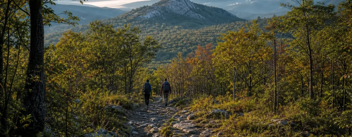
The Appalachian Trail starts at Springer Mountain in northern Georgia and ends at Katahdin’s Baxter Peak in Baxter State Park, Maine. For 2026, the official trail length is 2,197.9 miles [3,537 km], passing through 14 states.
Where does the Appalachian Trail start and end on the map?
It runs from Georgia to Maine along the Appalachian Mountains. The southern terminus sits on Springer Mountain in the Chattahoochee National Forest of Georgia, and the northern terminus sits on Baxter Peak, the highest summit of Katahdin, inside Baxter State Park in Maine.
The Appalachian Trail Conservancy’s A.T. Basics page lists the official 2026 length as 2,197.9 miles [3,537 km] and confirms the endpoints: Springer Mountain, Georgia, to Katahdin, Maine. The number changes when trail crews relocate tread, repair damage, or move the route for conservation and safety.
That means the A.T. is not a straight line, and it does not simply “go north.” It wiggles over ridges, drops into gaps, crosses roadways, skirts towns, and climbs through the old folds of the Appalachians. You pass through Georgia, North Carolina, Tennessee, Virginia, West Virginia, Maryland, Pennsylvania, New Jersey, New York, Connecticut, Massachusetts, Vermont, New Hampshire, and Maine.
| Endpoint | Location | What you see there | Typical use |
|---|---|---|---|
| Southern terminus | Springer Mountain, Georgia | Bronze plaque, trail register, summit sign | Most northbound thru-hikers start here |
| Northern terminus | Baxter Peak on Katahdin, Maine | Summit sign, alpine terrain, huge views | Most northbound thru-hikers finish here |
Where does the Appalachian Trail start for northbound hikers?
Northbound hikers start at Springer Mountain in Georgia. The summit is mile 0.0 for a NOBO hike, and the first white blaze points you toward Maine.
Springer Mountain is not a drive-up roadside kiosk. You reach it by foot. The common practical choices are to hike the Approach Trail from Amicalola Falls State Park or come in from the U.S. Forest Service Road 42 parking area and walk south to the summit before turning north.
The Georgia Appalachian Trail Club trail guide lists Springer Mountain at mile 0.0 and 3,782 feet [1,153 m]. It also lists the Southern Terminus Access Trail from Amicalola Falls State Park as 8.8 miles [14.2 km], blue-blazed, and separate from the official A.T.
If you want the ceremonial start, Amicalola feels right. You sign in, climb away from the visitor center, pass the falls, and earn the summit before your first official A.T. mile. If you want to start on the A.T. itself with less approach mileage, the Forest Service Road 42 access is the shorter walk to Springer.
- Most classic start: Amicalola Falls State Park Approach Trail to Springer Mountain.
- Shortest common access: Forest Service Road 42 parking, then a short hike to the Springer summit.
- Official mile 0.0: Springer Mountain summit, not Amicalola Falls.
- First direction for NOBO hikers: tag the summit, then follow white blazes north.
Where does the Appalachian Trail end?
The Appalachian Trail ends on Baxter Peak, the summit of Katahdin in Baxter State Park, Maine. For northbound hikers, this is the final climb and the emotional finish line.
Katahdin is not a casual victory lap. The last miles rise above treeline, weather can turn hard, and Baxter State Park manages access tightly to protect the mountain. The A.T. route up Katahdin is the Hunt Trail inside the park.
The Baxter State Park A.T. page states that the park contains the northernmost 10 miles [16 km] of the Appalachian Trail and that those miles terminate on Katahdin’s summit. It also says all long-distance A.T. hikers must secure a Long-Distance Hiker Permit in person at the Katahdin Stream Campground Ranger Station before attempting to summit, as of November 2026.
For a NOBO thru-hiker, the finish usually looks like this: enter Baxter from the south, reach Katahdin Stream Campground, get the required long-distance permit, climb the Hunt Trail to Baxter Peak, touch the sign, then descend. You do not camp on the summit. You do not assume the mountain is open. You check Baxter’s current trail status before your climb.
Is Springer Mountain the same as Amicalola Falls?
No. Springer Mountain is the official start; Amicalola Falls is a popular approach point. The distinction matters when you count miles.
Amicalola Falls State Park is where many hikers begin the experience, especially first-time thru-hikers heading north. The blue-blazed Approach Trail leads from the park to Springer Mountain. Once you reach Springer, the official A.T. begins at mile 0.0.
So if you hike from Amicalola to Springer and then continue north, those 8.8 miles [14.2 km] are real miles on your legs, but they are not counted in the official 2,197.9-mile [3,537 km] A.T. total for 2026. Plenty of hikers still count them in their personal trip story. The trail does not care either way. Your knees will remember.
Can you hike the Appalachian Trail southbound instead?
Yes. Southbound hikers start at Katahdin and finish at Springer Mountain. This is called a SOBO hike.
SOBO is less crowded at the start, but it throws you into harder terrain early. Maine and New Hampshire are rugged, remote, wet, rocky, rooty, and slow. You also have to work around Baxter State Park’s seasonal access and Katahdin’s opening date, which depends on spring conditions.
Northbound hikes usually start in late winter or spring in Georgia and finish in Maine before Baxter’s fall closure window. Southbound hikes usually wait until Katahdin opens for summer hiking, then move south through Maine’s hardest country right away.
| Direction | Start | Finish | Best fit |
|---|---|---|---|
| NOBO | Springer Mountain, Georgia | Katahdin, Maine | Hikers who want the classic A.T. progression |
| SOBO | Katahdin, Maine | Springer Mountain, Georgia | Hikers ready for tough northern terrain early |
| Flip-flop | Any chosen midpoint | Often Springer or Katahdin | Hikers avoiding crowds, heat, or deadline pressure |
How far is the Appalachian Trail from start to finish?
The official 2026 distance is 2,197.9 miles [3,537 km]. That number runs from Springer Mountain to Katahdin on the official white-blazed route.
The mileage is updated by the Appalachian Trail Conservancy as the trail changes. A relocation that protects a wetland, bypasses a damaged area, or improves sustainability can add or subtract distance. That is why old signs, older guidebooks, and trail stories may quote different totals.
Do not build a trip plan from a single old number. Use current maps, a current guide, and the official A.T. interactive map when you are planning sections, road crossings, resupplies, and access points.
What states does the Appalachian Trail pass through from start to end?
The Appalachian Trail passes through 14 states. From south to north, they are Georgia, North Carolina, Tennessee, Virginia, West Virginia, Maryland, Pennsylvania, New Jersey, New York, Connecticut, Massachusetts, Vermont, New Hampshire, and Maine.
The state line count sounds neat. The terrain is not. Georgia gets you climbing fast. North Carolina and Tennessee bring big southern ridges. Virginia is the longest state on the A.T. Pennsylvania has its famous rocks. New England steepens the pitch. Maine finishes with mud, roots, ponds, river crossings, and Katahdin standing like a wall at the end.
If you are section hiking, the endpoints still matter. You can build your route northbound or southbound, state by state, or in chunks that fit your vacation time. The trail does not require one continuous push unless you are chasing a thru-hike.
Do you need permits to start or finish the Appalachian Trail?
You do not need one single trail-wide permit, but some managed areas require permits. As of November 2026, the key permit zones include Great Smoky Mountains National Park, Shenandoah National Park, and Baxter State Park.
For the start at Springer Mountain, there is no A.T.-wide permit booth waiting at mile 0.0. For the finish at Katahdin, Baxter State Park rules are a bigger deal. Long-distance A.T. hikers must get the Baxter Long-Distance Hiker Permit in person before climbing Katahdin.
In Great Smoky Mountains National Park, backcountry camping requires a permit and advance reservation, and the park moved new backcountry permits to Recreation.gov on April 30, 2026. The Great Smoky Mountains National Park backcountry camping page lists the Appalachian Trail thru-hiker pass at $44.50 and the general backcountry camping fee at $8 per person, per night plus a $6 non-refundable permit fee, as of November 2026.
Shenandoah National Park also requires backcountry camping permits for overnight trips. Before you enter any national park, state park, national forest, or special management zone, check the current land manager page. Fees, fire rules, bear canister rules, parking systems, and campsite rules can change during a single hiking season.
How do you choose the best place to start?
Choose the start that matches your direction, season, fitness, and transportation. The “right” start is the one that gets you on trail safely and legally.
For a full thru-hike, your first big decision is direction. For a shorter hike, think in terms of access, weather, terrain, and exit points. A weekend hiker does not need to start at Springer just because the A.T. does.
- Pick your hike type. Decide if you are day hiking, backpacking a section, thru-hiking, or flip-flopping.
- Pick your direction. NOBO starts at Springer. SOBO starts at Katahdin. Flip-flops start where the season makes sense.
- Check access. Look at trailheads, parking, shuttles, road conditions, and seasonal gates.
- Check permits and rules. Look up the exact land manager for every overnight zone on your route.
- Build a conservative first week. Start with shorter days than your ego wants. The A.T. punishes rushed ankles, knees, and shoulders.
- Carry current maps. Apps help, but batteries die. A paper map and basic compass skills still belong in your kit.
What should you know before hiking from one end to the other?
The A.T. is long, wet, steep, social, lonely, beautiful, and repetitive. The endpoints are simple; the middle is where the work happens.
A full hike is not just a line from Georgia to Maine. You are managing food carries, storms, foot care, sleep, morale, water treatment, town stops, cold snaps, heat, black flies, crowded shelters, private land boundaries, and daily decisions. Some days are magic. Some are a green tunnel with sore feet.
Use this quick pre-trip checklist before you aim yourself at either terminus:
- Current A.T. maps or guide data
- Rain gear and a shelter system you can pitch fast
- Water filter or chemical treatment
- Bear-resistant food storage where required, and solid food-hanging skills elsewhere
- Headlamp, spare power, and backup fire starter
- Insulation for the coldest likely night, not the average afternoon
- Footwear already tested on steep, wet trail
- Printed or saved permit confirmations where required
- Emergency contact plan for low-service areas
- Willingness to turn around when weather, injury, or closures say so
The Appalachian Trail starts and ends at two named mountains, but your hike starts earlier than that. It starts when you make honest plans, check the rules, pack what you can carry, and leave room for the trail to change your schedule.
Related reading
- How Long Is the Appalachian Trail? Miles, States and Time
- How Long Does It Take to Hike the Appalachian Trail?
- What States Does the Appalachian Trail Go Through?
- How to Hike the Appalachian Trail: Planning a Thru-Hike
FAQ
Where is the official start of the Appalachian Trail?
The official start is Springer Mountain in Georgia. If you hike northbound, Springer is mile 0.0 of the Appalachian Trail.
Where is the official end of the Appalachian Trail?
The official end is Baxter Peak on Katahdin in Baxter State Park, Maine. For northbound hikers, this is the final summit of the A.T.
Is Amicalola Falls part of the Appalachian Trail?
No. Amicalola Falls is the start of the 8.8-mile [14.2 km] Approach Trail to Springer Mountain. Many hikers begin there, but the official A.T. begins on Springer.
How long is the Appalachian Trail in 2026?
The official 2026 length is 2,197.9 miles [3,537 km]. That mileage runs from Springer Mountain, Georgia, to Katahdin, Maine.
Can you start the Appalachian Trail in Maine?
Yes. That is a southbound, or SOBO, hike. You start at Katahdin and hike south to Springer Mountain, but you must follow Baxter State Park access rules before climbing Katahdin.
Which direction is easier, northbound or southbound?
Northbound is usually the more beginner-friendly direction because the first weeks in Georgia and the southern Appalachians let many hikers build trail fitness before Maine and New Hampshire. Southbound starts with harder, more remote terrain and requires careful timing around Katahdin’s seasonal access.